Historic European maps reveal how Ukraine was seen in 16th-18th centuries

 Photo: What Ukraine looked like on European maps in the 16th-18th centuries (Getty Images)
Curious about what Ukraine looked like on ancient European maps? In the 16th-18th centuries, our lands were sometimes indicated as Rus', sometimes as Podillia or Volhynia, and later as "the land of the Cossacks." It was during this period that the first detailed map with the name "Ukraina" was created by the Frenchman Guillaume Le Vasseur de Beauplan. Old maps not only reflect geography but also show how Europe's perception of Ukrainian lands changed over time. Here are the maps Europeans used, what they showed, and why they are important today.
16th century: First European impressions
Ukraine was depicted as part of a larger region of Rus' (Ruthenia), Podillia, Volhynia, and Crimea.
On Sebastian Münster's maps (1540), Kyiv (Kyovia) and the Dnipro River (Borysthenes) appear.
Mercator (16th century) marked Crimea as Taurica Chersonesus and recorded Rus' lands as separate regions.
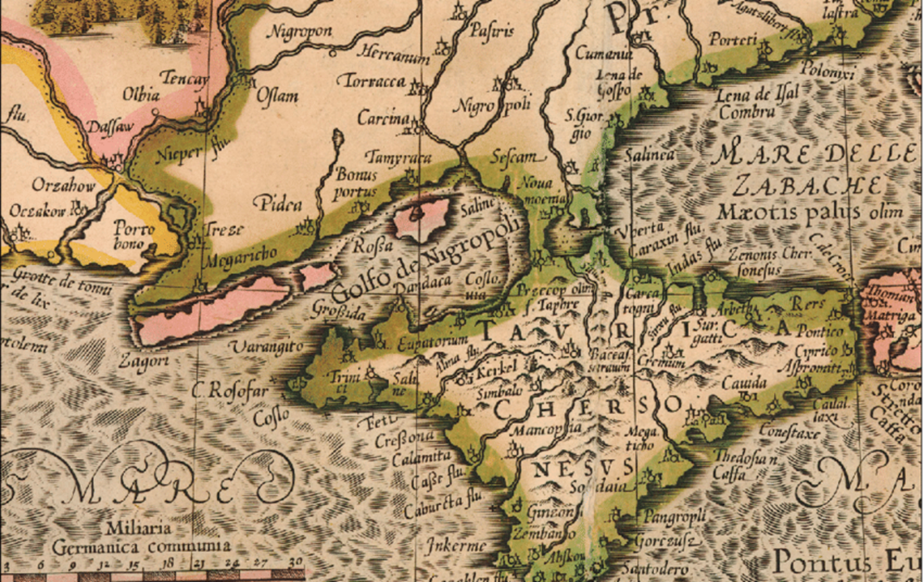 Taurica Chersonesus (photo: ResearchGate)
17th century: Beauplan and first map of Ukraine
French engineer and cartographer Guillaume Le Vasseur de Beauplan created the first detailed map named "Ukraina" (1639).
In 1648, his General Map of Ukraine was published in Gdańsk at a scale of 1:1,800,000, showing hundreds of cities, rivers, and fortifications.
This was the first map dedicated exclusively to Ukrainian lands. It spread across Europe and established the name "Ukraine" in cartography.
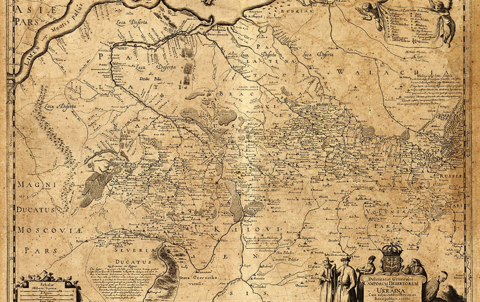 General plan of the Wild Fields, in other words, Ukraine, with its provinces (photo: Wikipedia)
17th-18th centuries: Cossack state on maps
Guillaume Sanson (1674) published the map Vkraine ou Pays des Cosaques, "Ukraine, the land of the Cossacks."
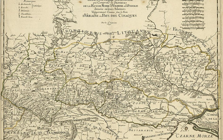 Vkraine ou Pays des Cosaques (photo: Wikipedia)
Johann Homann (1716) issued the map Ukrania quae terra Cosaccorum, "Ukraine, the land of the Cossacks."
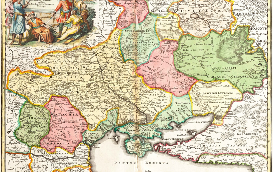 Ukrania quae terra Cosaccorum (photo: Wikipedia)
What maps reveal about Ukraine
Ukraine has always been a space at the crossroads of civilizations and military interests. European maps reflected shifting borders, cultural features, and perceptions of the Ukrainian people.
From the 17th century onward, Ukraine ceased to be a "nameless territory" and became a recognizable region on the map of Europe.
Previously, we wrote about Ukrainian holidays that were prohibited in the USSR.
Sources: Wikipedia, Radio Liberty, Harvard MAPA Project, OldWorldActions, ResearchGate.