Dniester: Ukraine's river full of secrets and surprises

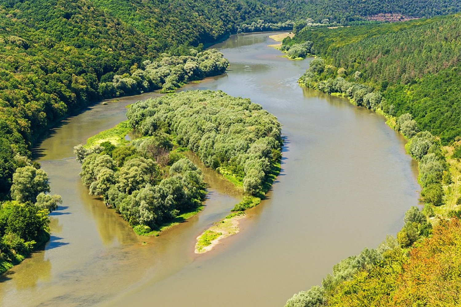
 Why the Dniester is a unique Ukrainian river (Photo: Wikipedia)
The Dniester amazes not only with its length or beauty, but also with the depth of its meaning—geographical, historical, cultural, and even spiritual. This river shapes a distinctive microclimate, national identity, and regional cooperation. Here are interesting facts about the most extraordinary river in Ukraine.
Geographic giant with character
The Dniester is Ukraine's second-longest river, flowing more than 1,362 km from the Carpathians to the Black Sea. Its source is located at an altitude of 900 meters above sea level in the Roztochchia area of the Lviv region.
The river basin covers over 72,000 square kilometers and spans two countries—Ukraine and Moldova. It forms more than 400 km of international border, which is strategically and geopolitically significant.
"Dniester" has Iranian roots and translates as "fast water," which reflects its changeable, vibrant nature. In ancient times, the Greeks knew it as Tiras, and the river captured the imagination even then.
Natural wonder: canyons, waterfalls, mists
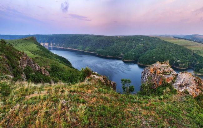
One of the most impressive formations is the Dniester Canyon, one of the largest in Europe and included in the Seven Natural Wonders of Ukraine.
Its cliffs reach up to 250 meters in height, and the landscapes astound with wild, picturesque beauty. Within the canyon, there are karst caves, waterfalls, and mineral springs.
In the upper reaches of the river, "Carpathian fogs" form—a rare atmospheric phenomenon that creates a microclimate with unique biodiversity.
Over 60 fish species have been recorded in the river channel, including rare ones such as the Danube sheatfish, sterlet, and European catfish. The river valley is home to over 1,200 plant species and is a nesting ground for over 100 bird species.
 Dniester Canyon (Photo: Wikipedia)
Historical witness of millennia
The Dniester remembers cities that no longer exist and trade that once connected the Balkans with the Baltic. It flows through ancient Halych, Khotyn, and Kamianets-Podilskyi— cities that are fortresses and symbols. In the Middle Ages, the river was a natural border between empires: the Ottoman Empire, the Polish-Lithuanian Commonwealth, and Russia.
Archaeologists have discovered dozens of Neolithic, Eneolithic, and Bronze Age settlements in the Dniester valley. In the 20th century, the Dniester became a tragic witness to the Holocaust, deportations, and armed conflicts.
Cultural and spiritual artery of the regions
Around the Dniester, unique household and spiritual traditions developed, including fishing, boat-making, and crafts. In riverside villages, elements of wooden sacred architecture, such as churches, bell towers, and chapels, remain.
In the folk beliefs of Podillia and Bukovyna, the Dniester held an almost sacred status—many legends and songs are associated with it. In Moldova, the river is called Nistru and is also a symbol of national memory and culture.
Dozens of ecotourism routes pass through here every year, combining history, nature, and active recreation. The river allows people to rediscover themselves in the silence of the water and the rustle of the reeds.
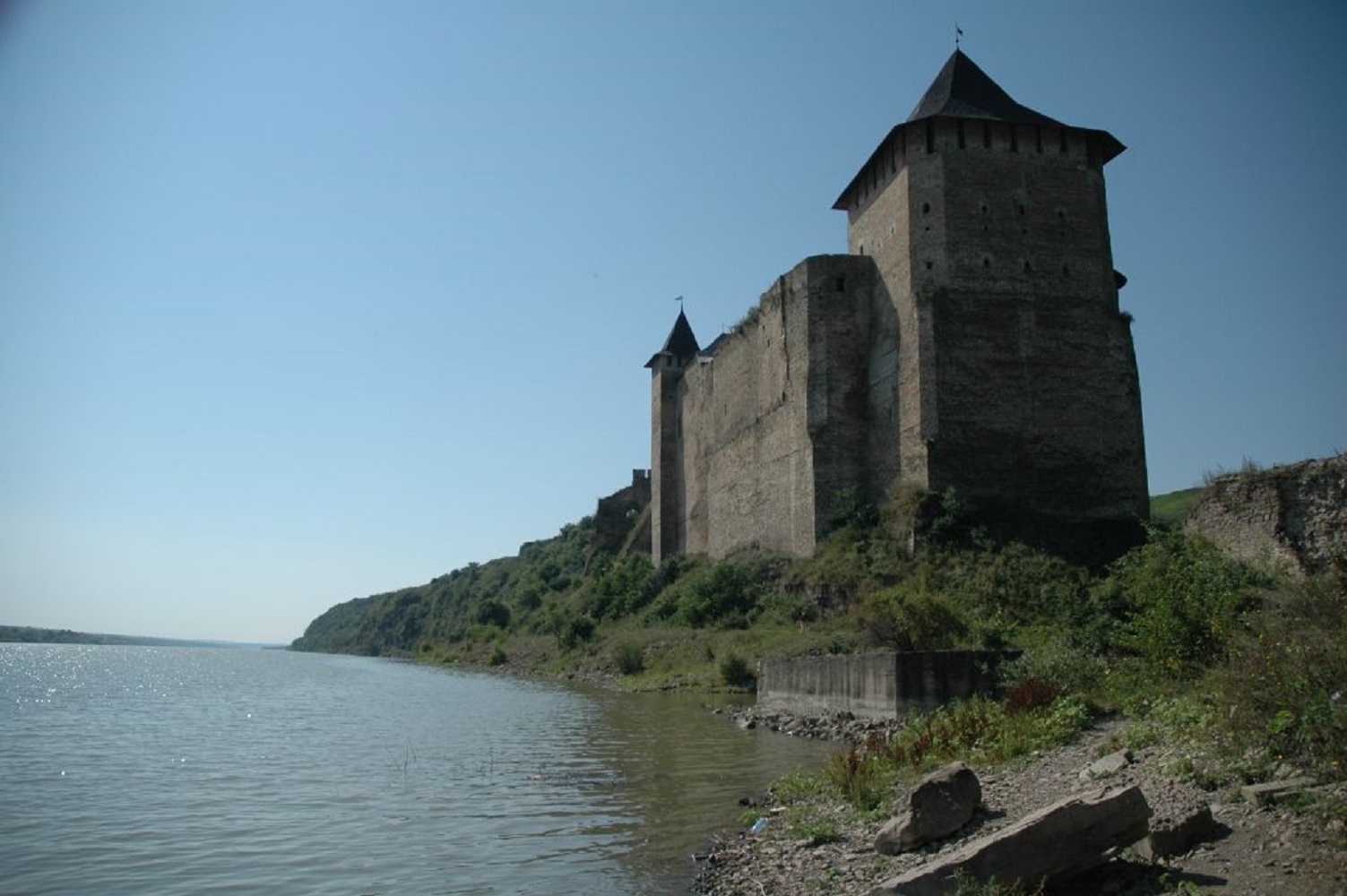 The Dniester near Khotyn Fortress (Photo: Wikipedia)
The Dniester today
The river sustains more than three million people as a source of drinking water, irrigation, and electricity. The Dniester Hydroelectric Station is a large hydropower complex, and the river itself supports dozens of reservoirs and dams.
However, modern times bring challenges—eutrophication, pollution, and climate change threaten the ecosystem. Reserves and protected areas operate in the basin, along with UN and UNESCO programs for water resource conservation.
Sources: websites Visit Ukraine, Trip Advisor, and Wikipedia.