Border tensions escalate: Updates from Sumy with new battle maps

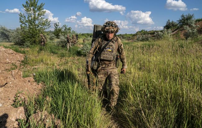 Photo: Fighting continues in Sumy region (Getty Images)
Russia continues shelling populated areas in Sumy region. Fighting also continues along the border territories.
Below is the current battle map of Sumy region from RBC-Ukraine.
According to DeepState analysts, the red zone on the map is expanding, now covering over 189 square kilometers.
Analysts report that Russian forces have taken control of the village of Loknya, located north of the Yunakivka community center.
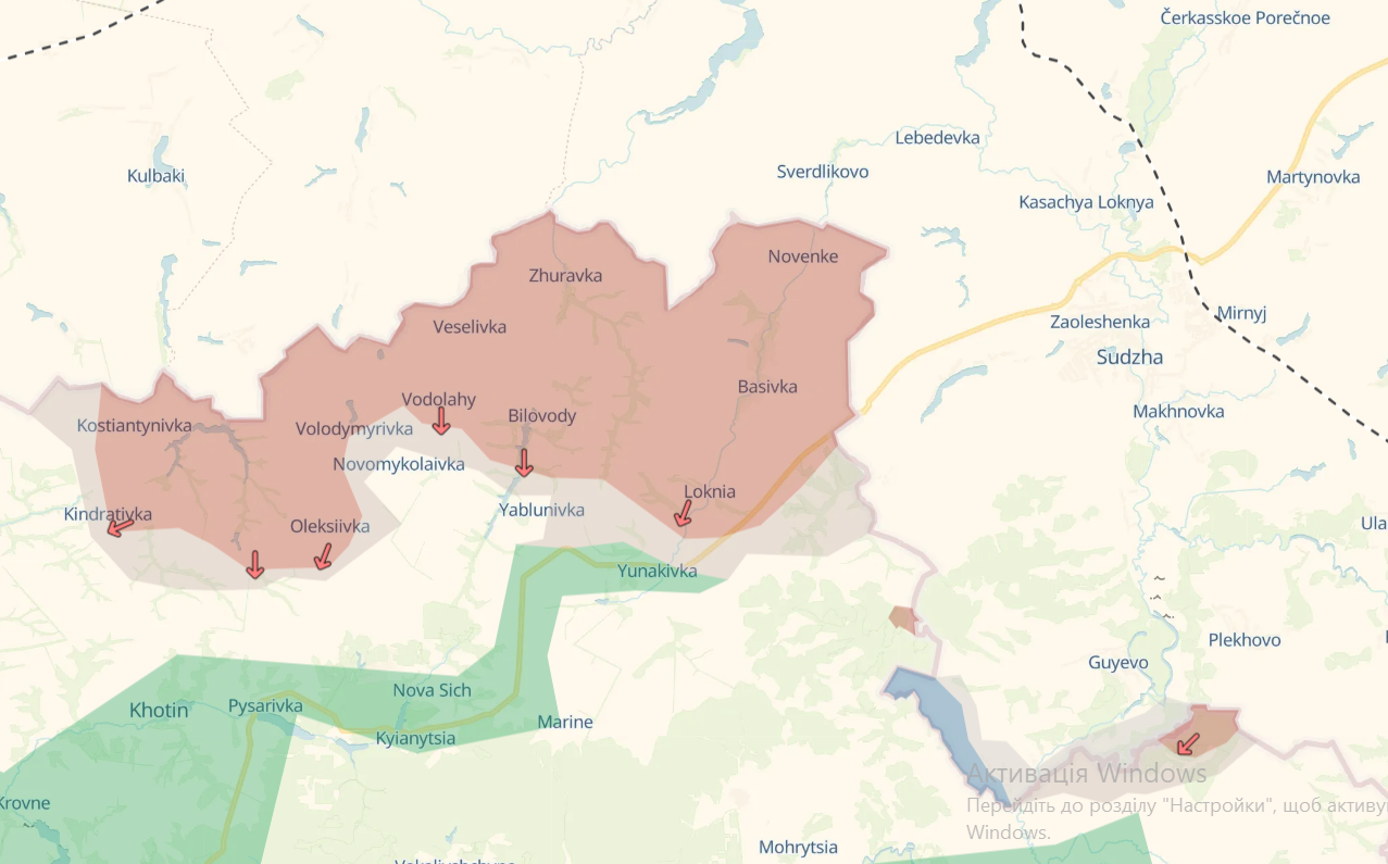
Photo: DeepState battle maps for June 8 (deepstatemap.live)
What ISW says
The Institute for the Study of War (ISW) report notes that, based on geolocation data, Russian forces recently advanced northeast of Kindrativka, south of Oleksiivka, east of Yablunivka, and east of Loknya.
According to ISW, Russian "war correspondents" claimed that Ukrainian forces launched counterattacks south of Kindrativka and near Yunakivka.
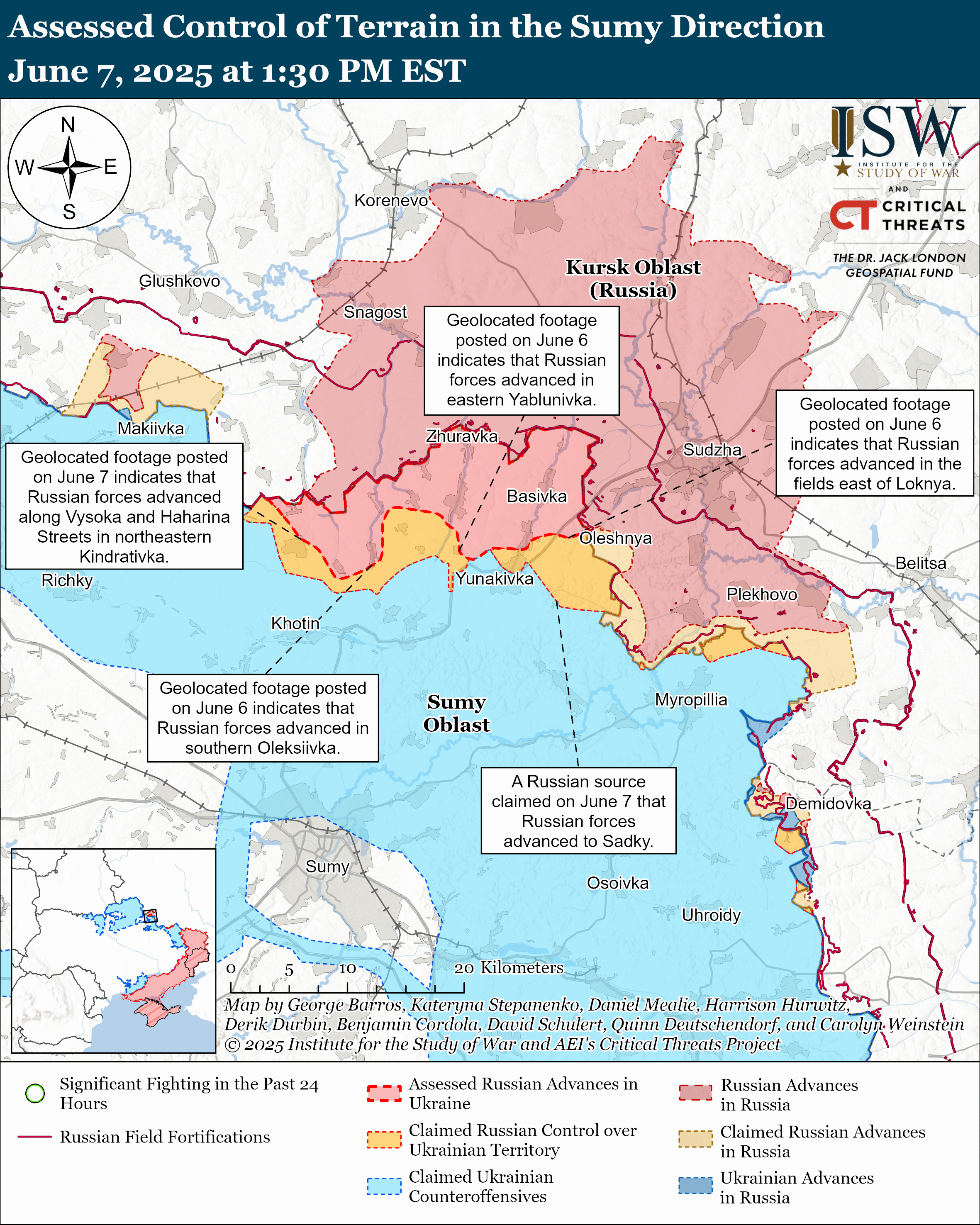
Photo: ISW battle maps (understandingwar.org)
Situation in Sumy region
According to the regional military administration, over the past day, Russian occupiers carried out more than 80 attacks on 27 settlements across 12 territorial communities in the region.
The highest number of shellings was recorded in the Sumy and Shostka districts. The enemy used guided bombs (KAB), multiple launch rocket systems (MLRS), and drones.
Civil infrastructure was damaged in the Hlukhiv and Mykolaiv communities. Twenty-four people were evacuated yesterday from border communities.
Recently, Russian forces have intensified offensive actions along the border of Sumy region. Russia aims to establish a so-called “buffer zone.”
The State Border Guard Service reported active enemy sabotage and small assault groups operating in the border areas. President Volodymyr Zelenskyy stated that Russia is amassing troops near the Sumy direction. According to him, more than 50,000 Russian troops are currently concentrated there.
Recently, Special Operations Forces destroyed an enemy group on the Kursk direction that attempted to break into Sumy region.