Fighting in Kursk region: Map of gray zones as on August 9

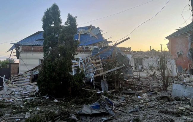 Photo: fighting in the Kursk region has been going on for four days (Russian media)
The military operation in the border area of the Kursk region continues for the fourth day. The Russian side claims that the fighting is allegedly already taking place 30 kilometers from the Kursk nuclear power plant and 15 kilometers from another district center, Lgov. Meanwhile, Ukrainian analysts have for the first time marked gray and liberated zones on the map of the fighting.
RBC-Ukraine has compiled the latest developments in the Kursk region on the fourth day of fighting, maps, and possible options for Russian troops.
Contents
- What's happening in Kursk region: analysis, battle maps
- How Russia can act: four possible scenarios from ISW
According to the morning estimates of the Russian media outlet Important Stories, the battle zone has already stretched over 800 square kilometers, and up to 450 square kilometers are allegedly under the fire control of the Armed Forces of Ukraine. Russian media claimed that Ukrainian forces had gone about 30 km deep into Russia and occupied or stormed 22 settlements, including two district centers: Korenevo and Sudzha.
The situation in another district center, the city of Lgov, is also alarming for Russians, as locals have already begun to leave en masse. Russian Telegram channels write that allegedly Ukrainian soldiers can go not only to Kursk but also to the Kursk Nuclear Power Plant, which is located in the city of Kurchatov. There are about 50 kilometers from this settlement to the nearest place of fighting, although Z-channels say it is 30 kilometers. In addition, some Russian military reporters write about the fighting for Rylsk, which is also a regional center.
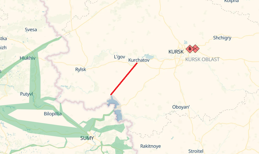
Photo: fighting in the Kursk region is getting closer to the local nuclear power plant in Kurchatov (screenshot by deepstatemap)
What's happening in Kursk region: analytics, battle maps
For the first time since the beginning of the breakthrough, the Ukrainian analytical resource DeepState has shown a map of the fighting in the Kursk region. Experts have marked the settlements that are not controlled by Russia in the region (this is an update for August 6).
"Updates will be delayed. Some information may ultimately differ from the testimony of direct participants in the events," DeepState explains.
According to the analysts, the Ukrainian Defense Forces liberated Sverdlikovo, Daryino, and Oleshnya.
"The Ukrainian Defense Forces struck near Sverdlikovo and Oleshnya. The first village was captured as a result of a battle, and the second without a fight or with minimal effort," the statement says.
According to experts, about two platoons of the Russian troops are surrounded at the Sudzha checkpoint. The village of Gornal was also surrounded.
"Advance groups have reached Goncharovka and the outskirts of Sudzha. Fighting in the area of Zelenyi Shlyakh, intensity is unknown. In Nikolaevo-Daryino, Russia's stronghold managed to hold off the first attack, but not for long," DeepState adds.
In total, the area of the liberated territory in the two areas is 72.74 square kilometers and 70.25 square kilometers, respectively. The gray zone in the Kursk region covers an area of 110.71 square kilometers.
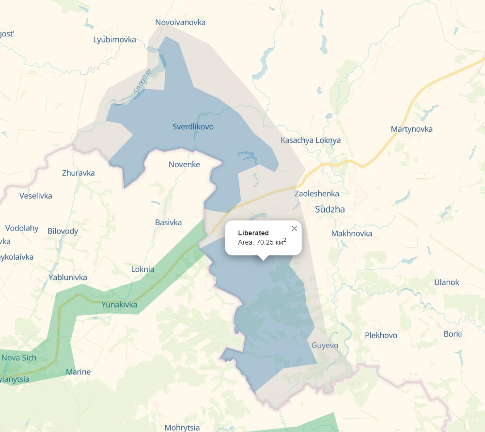 Photo: DeepState for the first time showed on the map the liberated territories and the gray zone in the Kursk region on the first day of the operation (screenshot deepstatemap)
The American Institute for the Study of War (ISW) writes about the presence of Ukrainian troops in Russian areas located 35 kilometers from the internationally recognized border with the Sumy region of Ukraine.
"However, Ukrainian forces certainly do not control the entire area within Russia's maximum claims of Ukrainian troop advances in the Kursk region," ISW notes.
 Photo: map of Ukrainian advance in Kursk region by Radio Liberty (svoboda.org)
Based on geolocated footage and Russian statements, analysts name the areas where the Ukrainian military could have advanced:
- Sudzha. Some Russian military officials complain that the town has already been captured, while others say that the Russians do not control only part of the settlement.
- Miliutino and Kromskie Byki (35 kilometers from the border). These villages are already part of the Lgov district of Kursk region. These villages are marked on the ISW map as the highest point where the Armed Forces of Ukraine could advance.
- Russkoe Porechnoe (north of Sudzha). Ukrainian forces have probably advanced toward the village. Meanwhile, Russian military officials report that Ukrainian troops are advancing further along the 38K-024 road near Anastasievka.
- Goncharovka and Zaoleshenka. Presumably, Ukrainian troops are operating in the area of the first settlement and to the north of the second. Although some Russian bloggers complain about the capture of Honcharivka.
- Novoivanovka (10 km from the border). A geolocation photo shows that Ukrainian forces are operating in this settlement, although Russians again claim to have captured it along with Bogdanovka (northwest of Sudzha).
ISW also cites several other Russian statements about the alleged movement of Ukrainian forces. They say that Ukrainian forces have also advanced to Mala Loknya and the outskirts of the village of Cherkasskoe Porechnoe, as well as in the area of Kruglenkoe, Martynovka, Bolshoe Soldatskoe and near Myrnyi, Sudzhansky district.
Russian military commanders also wrote about an attack near the villages of Snagost and Olgovka. These settlements are part of the Korenevo district.
 Photo: ISW map shows the alleged advance of the Ukrainian Armed Forces up to Myliutino in Luhansk district (understandingwar.org)
However, the Russian media outlet Agenstvo, which positions itself as an opposition to the government, claims that Luhansk is 10 kilometers away from the nearest point of fighting.
 Photo: map of the fighting from Agenstvo (agents.media)
How Russia can act: four possible scenarios from ISW
According to international analysts, the Russian military command has many possible options to respond to the cross-border operation in the Kursk region. ISW names four of them:
- First. Russia may decide to use its existing conscripts, Federal Security Service (FSB) border guards, the Russian Guard, and other irregular forces already deployed in the international border area to push back Ukrainian troops and defend itself against the Ukrainian operation in the Kursk region.
- Second. Decide on the use of the existing Northern Group of troops deployed along the Russian-Ukrainian border.
- Third. Redeploy operational reserves accumulated for the planned offensive efforts for the summer of 2024 and/or relatively better equipped and more capable forward units to the Kursk region from other regions of the theater.
- Fourth. Russia may seek to retain the forces it currently allocates to the Kursk region, but could redeploy a significant number of aviation and strike units to the area to improve its ability to retake the territory.
On August 6, 2024, after a massive shelling of the town of Sudzha, Russian media and local authorities reported a breakthrough of the border in the Sudzha and Korenivka districts of the Kursk region of Russia.
Initially, the Russian Ministry of Defense and the Russian FSB claimed that the attempts to break through were allegedly repelled. However, they later admitted that the fighting in the border area was still ongoing. A day after the incident, Russian President Vladimir Putin reacted, claiming a large-scale provocation and blaming Ukraine.
The Ukrainian military and political leadership did not confirm any involvement in the operation in the Kursk region. Amid the reports, President Volodymyr Zelenskyy only said that Russia should also feel the war. Ukraine's partners also did not speak out immediately but emphasized that Kyiv has every right to defend itself in this way.
Read more about the situation in the Russian border area in RBC-Ukraine's article.
Sources: the report and maps of the US Institute for the Study of War (ISW), maps of the analytical resource DeepState, the Telegram channel "Important Stories", open sources.