Scientists discover location of long-lost continent from millions of years ago
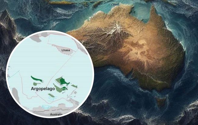
 What have we learned about the world's eighth continent? (Collage RBC-Ukraine)
Over 150 million years ago, there was another continent called Zealandia that existed between the modern territories of Australia and New Zealand. This continent eventually broke apart into numerous islands and submerged about 90% of its landmass. Find out more about this enigmatic lost continent in RBC-Ukraine report, based on Insider.
At a depth of over 1 km beneath the waves of the southern part of the Pacific Ocean lies the lost eighth continent. In 2017, scientists confirmed that this submerged landmass constitutes a separate continent, but what happened to it and what its exact size is remained unknown for many years.
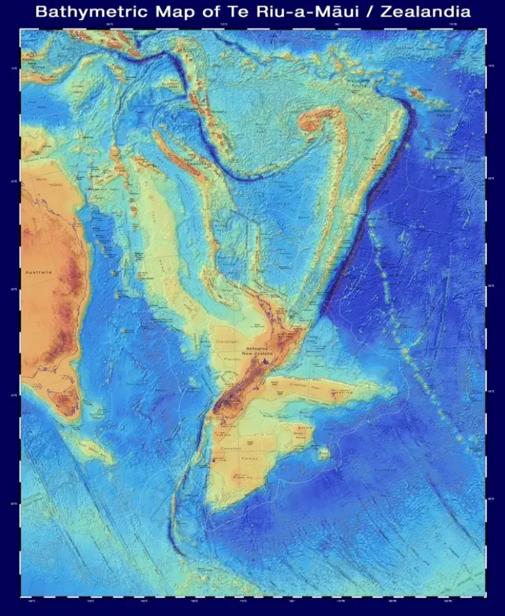
Only recently, a group of researchers from Utrecht University in the Netherlands managed to create a detailed map. They determined that Zealandia's area is approximately 5 million square kilometers, roughly half the size of modern-day Australia, with only 6% of it above sea level.
This landmass forms the basis of the northern and southern islands of New Zealand and New Caledonia. The rest lies underwater, making it challenging to study.
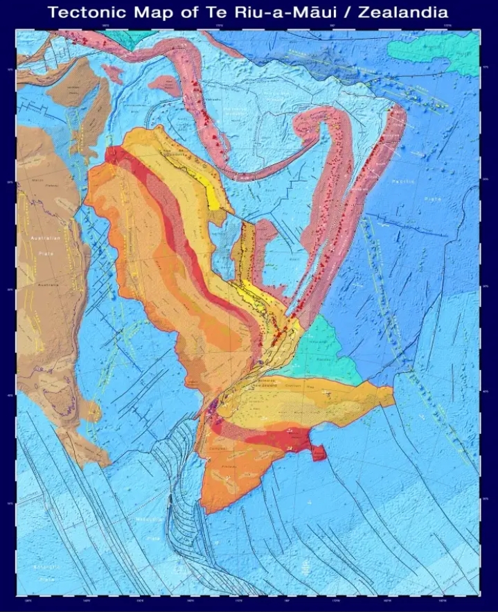
Scientists have also identified the type of crust and created a similar map, along with the age of the crust and major fault lines. The red triangles on the map indicate the locations of volcanoes.


Arnold's map (screenshot)
It was previously believed that New Zealand formed when it separated from the ancient supercontinent Gondwana about 85 million years ago. Gondwana, in turn, originated from the break-up of the ancient supercontinent Pangaea. Laurasia in the north became Europe, Asia, and North America, while the southern portion gave rise to Africa, Antarctica, South America, and Australia.
Geological forces continued to redistribute land masses, submerging Zealandia under the water some 30-50 million years later. Until 2017, Zealandia was classified as a microcontinent or Madagascar-like island.
However, it meets all the criteria for continent status, including its size, uplift relative to the surrounding oceanic crust, and continental crust thickness. Leading scientist Nick Mortimer argues that Zealandia should be considered the eighth continent.
Moreover, there are inaccuracies in the history of its origin. Researchers collected and dated basalt and sandstone rocks from the sea floor in the Fervent Ridge area of the Coral Sea, northwest of New Caledonia. Their ages range from 36 to 128 million years.
By gathering rock samples and mapping their locations across Zealandia, the team gained insights into geological forces, such as volcanic formation and crustal subsidence, as well as when they occurred.

Arnold's map of Zealandia (screenshot)
Zealandia is likely the lost sibling of Antarctica. Gondwana began to break up about 160 million years ago in the Late Jurassic. Geological evidence suggests that Zealandia fits into the supercontinent alongside Australia and Antarctica.
Most of western Antarctica is submerged underwater, and according to Mortimer, it was nested alongside Zealandia around 100 million years ago. As the crust cooled and thinned, Zealandia began to subside underwater and continued to do so approximately 25 million years ago. While the rising continental crust created mountains and islands, Zealandia, perhaps, was never entirely submerged.
"Adding Zealandia into the data mix is bound to give us some insights into why supercontinents break up. It also provides biologists with important information about the plants and animals — like ancient penguins — that lived on Zealandia," says Mortimer.
Previously, we reported on scientists discussing the potential existence of another continent. We also talked about the winter predictions made by scientists.

